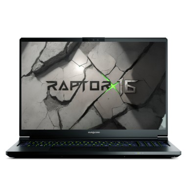
16" / 40.64cm QHD+ 2560-by-1600 pixels; 16:10 aspect ratio
Featuring the NVIDIA GeForce RTX 5070Ti, this 16-inch powerhouse redefines mobile gaming and power computing on the go.
EUROCOM Raptor X16 is powered by Intel Core Ultra 9 Processor 275HX 24C/24T Processor with 36M cache and NVIDIA GeForce RTX 5070Ti 12GB DDR7 with NVIDIA Blackwell architecture and 184 Tensor AI cores. It supports up to 24TB of NVME SSD storage in RAID 0/1/5 and two Thunderbolt 4 ports allowing up to 3 external monitors connected directly to dGPU.
With the perfect balance of performance and portability the Raptor X16 is designed for anyone - gamer, student, artist, engineer, AI developer - who refuse to and cannot compromise while on the go.
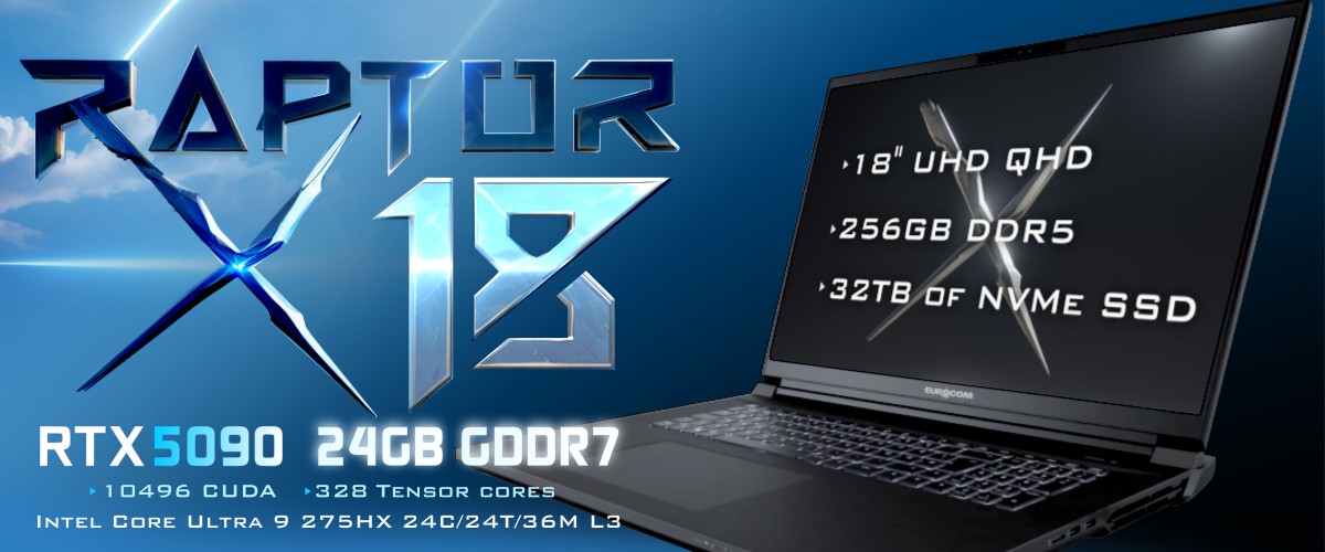
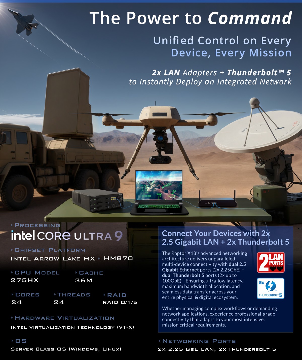
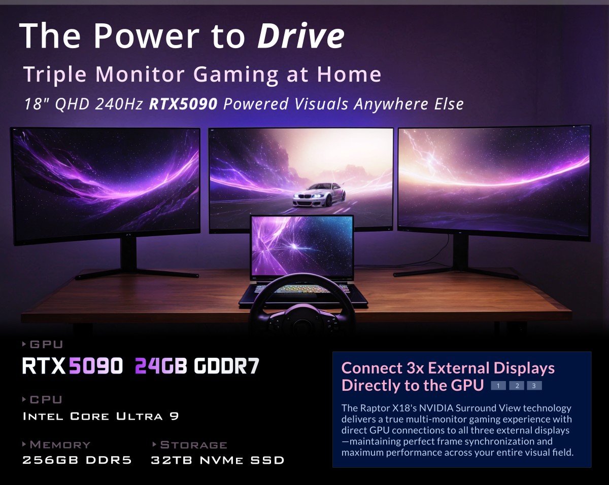
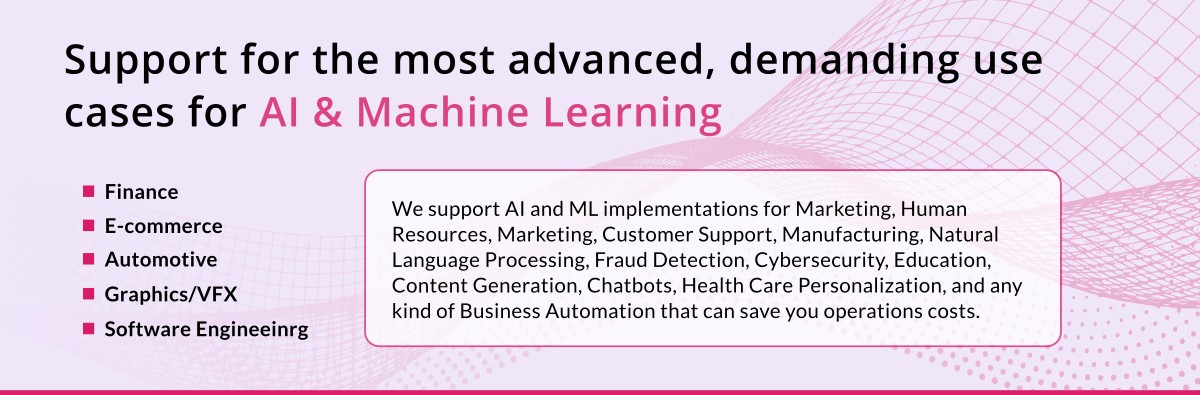
EUROCOM Raptor X18 Mobile Supercomputer is powered by Intel Core Ultra 9 Processor 275HX 24C/24T Processor with 36M cache and NVIDIA GeForce RTX 5090 24GB DDR7 with NVIDIA Blackwell architecture and 680 Tensor AI cores. It supports up to 32TB of NVME SSD storage in RAID 0/1/5 and two Thunderbolt 5 ports allowing up to 3 external monitors connected directly to dGPU. Supports the most advanced and demanding use cases in AI & Machine Learning in Finance, ECommerce, Security, Automotive, Forensic, Virtual Reality & Augmented Reality and other industries. Perfect for AI and EDGE computing on-the-go deployment.
The Raptor X18 features a sophisticated connectivity infrastructure that combines twin 2.5 Gigabit Ethernet ports with a pair of cutting-edge Thunderbolt 5 interfaces, creating an exceptional network foundation for portable servers & GPU cluster deployments.
With dual 2.5GbE connections, your data flows at 2.5 billion bits per second through each port, enabling robust network redundancy and load balancing capabilities essential for field operations. Simultaneously, the twin Thunderbolt 5 ports deliver blazing speeds up to 100GbE each, providing massive bandwidth for connecting high-performance peripherals or establishing lightning-fast device-to-device links.
This powerful combination gives you unprecedented flexibility for mobile server setups. Deploy virtualized environments, run distributed applications, or establish temporary command centers with confidence—knowing your network backbone can handle intensive data processing demands with minimal latency and maximum throughput.
Perfect for professionals who need enterprise-level networking capabilities - or military grade GPU compute - in dynamic environments, the Raptor X18's versatile port configuration accommodates complex networking topologies while maintaining exceptional performance for your most demanding, time-sensitive operations.
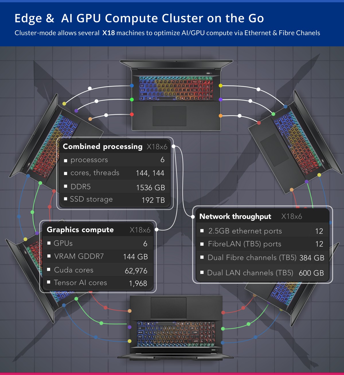
Edge / AI GPU computing cluster for on-the-go deployment consisting from SotG (Server on the Go) + hubs + multiple GPUs inside the laptops. Our platform strategy in support of AI & ML operations is the clustering of portable computing devices to provide flexibility, resilience, security, and scaleability. That enables a rapid deployment that may include a limited configuration, and next pending the resources demand it can be quickly scaled, as needed to support more computing power, and an increased number of users or transactions.
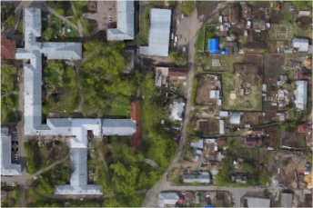
Scan the world with advanced imaging processing on the go.
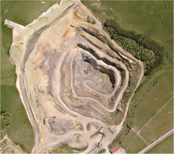
Mining and Quarrying
Calculate complex geometric models with PhotoScan software running on Eurocom hardware; get the accurate DEMs for volume calculation and process them on your Mobile Supercomputer on the ground. Or process them in the air in-flight during flybys for instant results on tracking, soil erosion and glacier studies. A Mobile Supercomputer is an indespensible part of GIS workflows and UAV systems.
Surveying and Mapping
PhotoScan is used for aerial triangulation, dense point cloud and orthomosaic generation - combined with Eurocom Mobile Supercomputers it is the perfect toolset for on-site and off-site processing. PhotoScan running on Mobile Supercomputer is capable of dense point cloud generation and classification for further high-resolution orthomosaics, exceptionally detailed DSMs/DTMs, and polygonal models of large scale objects.
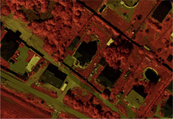
Agriculture and Environmental Management
Customizable vegetation index calculation, panchromatic, multispectral and thermal imagery support anywhere in the word from diverse sources by integrating a Mobile Supercomputer into your workflow. Render multispectral orthomosaics with the fastest mobile hardware available.
Supercomputers: High-Performance AI & Computing On the Go
Unlock extreme computing power with Intel Core Ultra 9, NVIDIA RTX 5090, and massive storage for AI, ML, and enterprise workloads.
Designed for AI training, finance, security, and engineering, mobile supercomputers offer up to 256GB memory, 32TB RAID storage, and multi-VM support
Experience unmatched processing with Intel Core Ultra 9, 24 cores, RTX 5090 with 680 Tensor AI cores, and Thunderbolt 5 for real-time data processing
Deploy mobile HPC solutions with high-speed networking, up to three LAN ports, secure computing, and enterprise-grade AI training capabilities
Future-proof workflows with cutting-edge supercomputers delivering extreme AI performance, deep learning power, and high-efficiency computing solution


 Weight: 3.6kg / 7.9lbs Thickness: 32.8mm/1.29in